119.06 km
Biking time: 5 hours 26 minutes
284.4 km total
Seriously? Why would you make a road do that? If there wasn’t a highway across Canada, we probably wouldn’t have done this trip. But some genius decided to pave the side of a mountain and now I have to ride my bike over it? In conclusion, today was painful.
Up at 6am today, but not on the road until 7:20am. Yesterday’s weather was nice and warm (not hot, but at least warm), but today’s cool, drizzly air did nothing to lift our spirits about the ride and probably led to the somewhat slower start. It was up and down the whole day and both ways were to the extreme. We heard that from Hope to the toll plaza was the worst climb of the trip – good call. By the time we got to Highway 5, which was about 5km from camp, I thought I was prepared for it. The climb actually started out gradually and at times it looked like we were going downhill, but when we looked back, it turned out to be a fairly decent incline. After about 25km we all took a rest and felt pretty good. We were wondering where the enormous hill was that we had heard so much about. About another 5km and it reared its ugly head.
It was massive and the sight made my legs hurt. I’m not sure how long it took to climb, but every second was painful. We went through a snow shed at about 5 or 6km from the summit (I think, but my mind wasn’t working too well at that point). At the summit, the valley below gave an incredible view and with the clouds probably no more than 50 feet over our heads, it felt like we had really conquered a big mountain. The sign claimed the Coquihalla Pass was 1244 metres, which is impressive, but after exerting that much effort, I was hoping it would be higher. Nevertheless, one horrendous climb finished and it’s on to the next one.
We were at the highest point of the day, so we knew it was downhill until we would stop at Merritt. That was good. What was bad was not having food. Needless to say, we were all really hungry and luckily, a resort in the woods wasn’t far past the toll plaza and, although there wasn’t a lot of food available, there was canned chili. The lady at the office let us use one of their vacant cabins to heat up the chili and get warmed up. We rested a bit after lunch, but we were soon back on our bikes and heading downhill (generally). There were a lot of short, mediocre climbs, followed by long, spectacular downhills.
Idiotically, Kinger and I decided to race down one, so two inexperienced bike riders, the bikes loaded with tents and camping gear were bombing down a long, relatively steep and totally unknown (to us) hill. Gogi decided not to join in, but said his knee was feeling a bit better. Of course, the rest of his legs were hurting by days end, so maybe that took his mind off the knee. We got to this campsite at 4:30 and we’ll treat ourselves to an early dinner at Subway tonight. We’re all exhausted, but tomorrow’s ride looks to be shorter and the climbs less biting.
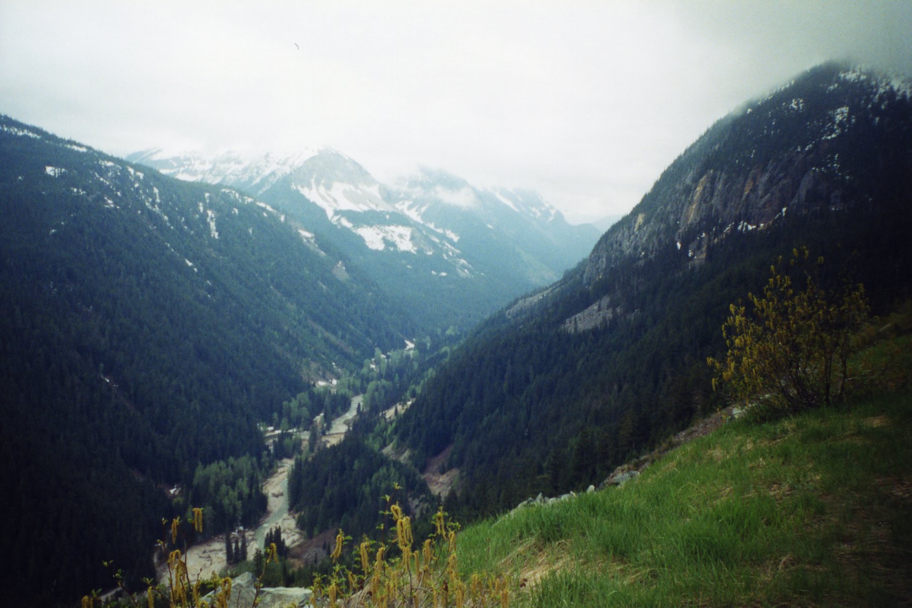
The view from the Coquihalla Highway.
LOOKING BACK, 10 YEARS LATER: A better cyclist would probably argue with my hyperbole about the hills, but the pain and exhaustion were very real for all of us. Still, the excitement had not worn off and I truly relished all the discomfort the mountains could provide.